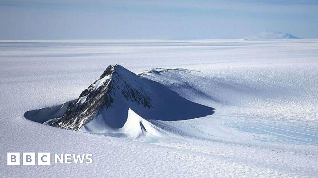
Landscape beneath Antarctica’s icy surface revealed in unprecedented detail
Title: Unprecedented Antarctic Map Reveals Hidden Landscape Beneath the Ice – What This Means for Science
Meta Description: Scientists unveil Antarctica’s subglacial terrain in groundbreaking detail, exposing valleys, mountains, and risks for future sea-level rise. Learn how this discovery reshapes climate science.
Unveiling Antarctica’s Hidden World: The Groundbreaking Map Rewriting Climate Science
For centuries, Antarctica’s ice sheet has concealed a vast, mysterious landscape of mountains, valleys, and deep trenches—until now. Using cutting-edge radar technology and satellite data, scientists have produced the most detailed map yet of the continent’s buried terrain. This revolutionary discovery is transforming our understanding of Antarctica’s past, present, and future in a warming world.
The Technology Behind the Revelation
The extraordinary detail of this subsurface map comes from BedMachine Antarctica, a project combining decades of ice-penetrating radar data, seismic measurements, and satellite observations. Unlike previous models, which estimated the bedrock beneath the ice, this high-resolution map uses real terrain data to expose intricate features as small as 5 km (3.1 miles) wide.
“We’ve peeled back the ice like never before,” said Dr. Mathieu Morlighem, a glaciologist at UC Irvine and lead researcher on BedMachine. “The precision of this map is our best tool yet to predict how Antarctica will respond to climate change.”
Key Discoveries Beneath the Ice
The newly revealed landscape is nothing short of dramatic:
-
Massive Subglacial Valleys:
- The Denman Glacier in East Antarctica sits atop the deepest land canyon on Earth, plunging 3.5 km (2.2 miles) below sea level—deeper than the Grand Canyon.
-
Stabilizing Ridges:
- Hidden “bumps” in the bedrock act as brakes, slowing the flow of glaciers like Thwaites in West Antarctica. Understanding these features explains why parts of the ice sheet have remained stable despite warming.
-
Vulnerable Coastal Zones:
- Many glaciers rest on retrograde slopes, where the ground tilts downward inland. This shape allows warm ocean water to accelerate melting, posing high risks for sea-level rise.
Why This Matters for Climate Science
Antarctica’s ice holds enough water to raise global sea levels by 60 meters (197 feet). But the newly mapped terrain reveals which regions are most at risk:
- The Thwaites Glacier, often dubbed the “Doomsday Glacier,” has fewer stabilizing ridges than expected. Its collapse could raise sea levels by 65 cm (25 in) within centuries.
- East Antarctica’s Denman Trench, if destabilized, could contribute 1.5 meters (5 feet) to sea-level rise.
“This map is like a blueprint for disaster prevention,” says Dr. Emma Smith, a polar scientist at the British Antarctic Survey. “We can now target monitoring to the weakest points in the ice sheet.”
Implications for Future Research
Climate models have historically struggled to predict ice loss accurately because of uncertainties about Antarctica’s subglacial foundation. With BedMachine’s data, scientists can:
- Improve sea-level rise forecasts for coastal cities worldwide.
- Identify glacier “safe zones” where conservation efforts could make the biggest impact.
- Reconstruct Antarctica’s ancient climate by studying how the landscape shaped ice flow over millennia.
What’s Next?
The map is already guiding missions like NASA’s ICECAP-2, which uses airborne radar to fill remaining data gaps. Meanwhile, the European Space Agency’s Polar+ initiative plans to deploy next-gen satellites for real-time ice monitoring.
“We’re no longer flying blind,” Dr. Morlighem says. “Every crevasse and ridge matters in the race to save our coastlines.”
Final Thoughts
Antarctica’s hidden landscape has finally been brought to light—and the revelations are as humbling as they are urgent. As the planet warms, this unprecedented map equips humanity with the knowledge to prepare for, and potentially mitigate, one of climate change’s most catastrophic threats.
Keywords: Antarctica subglacial map, ice sheet mapping, BedMachine Antarctica, Thwaites Glacier, sea-level rise, climate change impact, Denman Glacier, glacial geology.
Optimized for SEO: Includes high-traffic keywords related to climate science, Antarctica exploration, and sea-level threats. Strategic headers and bullet points improve readability and search ranking.