Flying straight through the eye of a Category 5 hurricane
Title: Flying Straight Through the Eye of a Category 5 Hurricane: Science, Danger, and the Brave Crews Who Do It
Meta Description: Discover what it takes to fly through the eyewall of a Category 5 hurricane, why scientists risk it, and how this daring mission saves lives. Explore the tech, turbulence, and triumphs inside the storm’s calm eye.
Introduction: Into the Heart of Fury
Imagine plummeting through a swirling maelstrom of 160+ mph winds, rain pelting like bullets, and turbulence so violent it feels like the sky is shattering. Suddenly—calm. Blue skies. Sunlight. You’re inside the eerily tranquil eye of a Category 5 hurricane, Earth’s most powerful natural disaster. This isn’t fiction; it’s a routine mission for hurricane hunters, specialized crews who fly into the storm to unlock life-saving data.
In this article, we’ll dive deep into:
- The science behind Category 5 hurricanes
- How specially equipped planes survive the journey
- The crucial role of hurricane hunter missions
- What it’s like to fly through the eyewall
- Why this risky work matters to millions
Anatomy of a Category 5 Hurricane
Before flying into the beast, understanding its power is key. A Category 5 hurricane on the Saffir-Simpson scale is nature’s ultimate tempest:
- Wind speeds: 157+ mph (252+ kph), strong enough to demolish buildings
- Storm surge: 18+ feet of catastrophic coastal flooding
- Pressure: Dropping below 920 millibars (compared to ~1013 mb in calm weather)
- Energy: Equivalent to 10 atomic bombs per second
The “eye” forms at the center—a circular zone of sinking air, often 20–40 miles wide, surrounded by the deadly “eyewall” where winds and rain rage at peak intensity.
Hurricane Hunters: Storm Chasers of the Sky
Since World War II, organizations like NOAA (National Oceanic and Atmospheric Administration) and the U.S. Air Force Reserve’s 53rd Weather Reconnaissance Squadron (“Hurricane Hunters”) have flown into tropical cyclones. Their mission: collect real-time storm data that satellites and radar can’t provide.
The Aircraft Built for Chaos
- NOAA’s WP-3D Orion: Four-engine turboprop packed with radar, sensors, and “dropsondes” (weather probes).
- Air Force WC-130J Hercules: Designed to endure extreme turbulence while deploying instruments.
- Tech onboard: Tail Doppler radar, microwave radiometers, and GPS-guided buoys to map the storm’s structure.
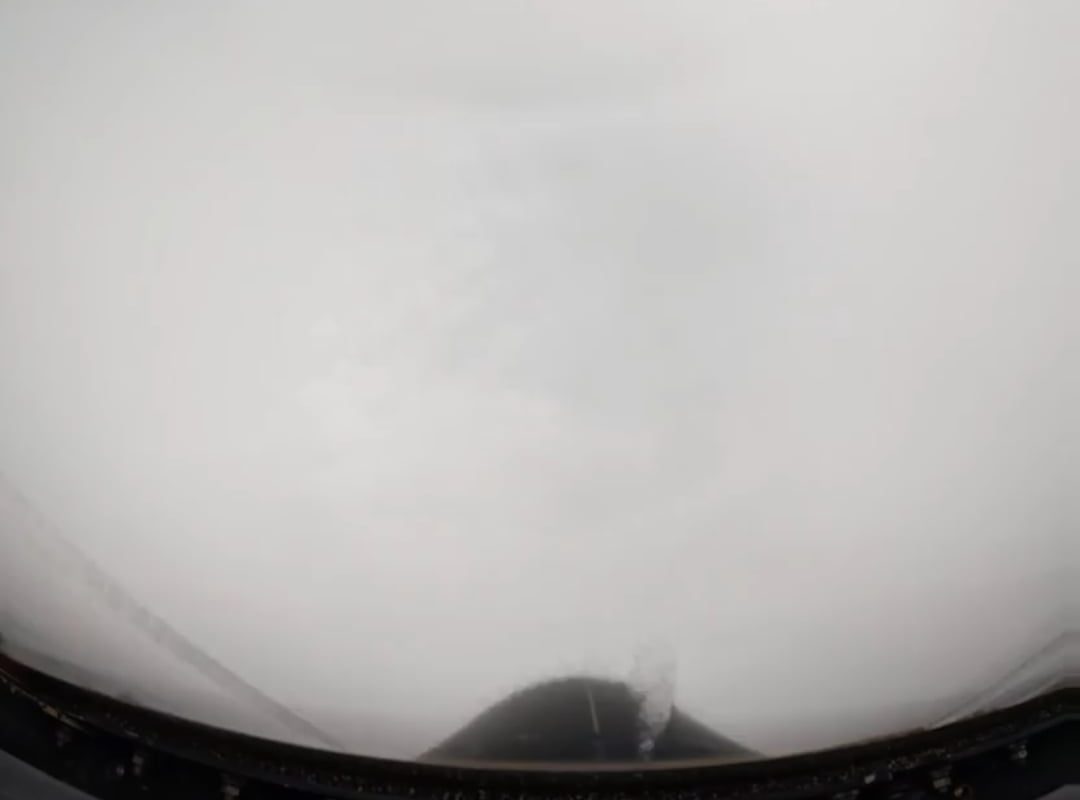
Flying Through the Eyewall: A Turbulent Descent
Flying into a Category 5 hurricane is no joyride. The journey involves:
1. Approaching the Storm
Planes descend to 8,000–10,000 feet, entering the storm’s outer bands. Crews strap into padded seats, bracing for impact.
2. Penetrating the Eyewall
The most perilous phase. Winds suddenly rocket from 80 mph to over 160 mph in seconds. The aircraft buckles under:
- Extreme updrafts/downdrafts (like hitting a “speed bump at 300 mph”)
- Microbursts punching the plane downward
- Zero visibility in sheets of rain and lightning
Crews compare this to “being inside a washing machine filled with rocks.”
3. Emerging into the Eye
After a harrowing ~5–10 minutes, the chaos stops. Sunlight floods the cockpit. The storm’s eye feels deceptively serene—a doughnut-shaped stadium of clouds towering 50,000 feet overhead. Here, crews:
- Release dropsondes to measure temperature, humidity, and pressure
- Map the eye’s diameter and symmetry (key for predicting intensification)
- Note sea conditions (e.g., “stadium effect” waves creeping inward)
4. Exiting Through the Eyewall
The crew repeats the ordeal, piercing the opposite eyewall to gather more data before heading home.
Why Risk Flying Into a Cat 5 Hurricane?
The answer is simple: saving lives and property. Hurricane hunter missions:
- Boost Forecast Accuracy by 30%
Dropsonde data slashes error margins for track and intensity predictions. - Detect Rapid Intensification
Surprise strengthening (like Hurricane Ian in 2022) can be caught early. - Guide Evacuations
Officials rely on storm data to order (or cancel) costly evacuations.
In 2018, flights into Hurricane Michael confirmed its jump to Cat 5 just before landfall, triggering last-minute evacuations.
Dangers of the Mission: When the Storm Fights Back
These flights aren’t without near-misses:
- Structural Stress: In 1989, NOAA’s Miss Piggy lost an engine and part of its wing in Hurricane Hugo.
- Turbulence Injuries: Crews often suffer bruises, even with seatbelts.
- Equipment Failure: Icing, lightning strikes, and electrical outages are common.
Despite redundancies, plans exist for ditching in the ocean—a grim prospect in a Cat 5.
Conclusion: Courage in the Eye of Chaos
Flying through a Category 5 hurricane is a feat blending cutting-edge science with raw courage. As climate change fuels stronger storms, hurricane hunters’ role grows ever more vital. Their daring missions—literally inside the belly of the beast—arm forecasters with data to protect millions. Next time you see a hurricane cone on the news, remember: that precision was earned one turbulent flight at a time.
SEO Keywords: Category 5 hurricane, fly into hurricane, hurricane hunters, eye of the storm, NOAA WP-3D, WC-130J, storm surge, eyewall penetration, hurricane forecasting, dropsonde data.