Mapping objects on a building with a laser
Title: Laser Mapping for Buildings: Precision, Efficiency, and Future-Proof Documentation
Introduction
In the age of digital transformation, industries like architecture, construction, and facility management demand faster, more accurate ways to capture building data. Laser mapping, also known as 3D laser scanning, revolutionizes how we document, analyze, and manage buildings by creating ultra-precise digital replicas of structures. This non-invasive technology uses lasers to measure objects on a building’s interior and exterior, turning physical spaces into actionable data. In this article, we’ll explore how laser mapping works, its key benefits, and the industries harnessing its power.
What is Laser Mapping for Buildings?
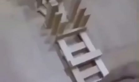
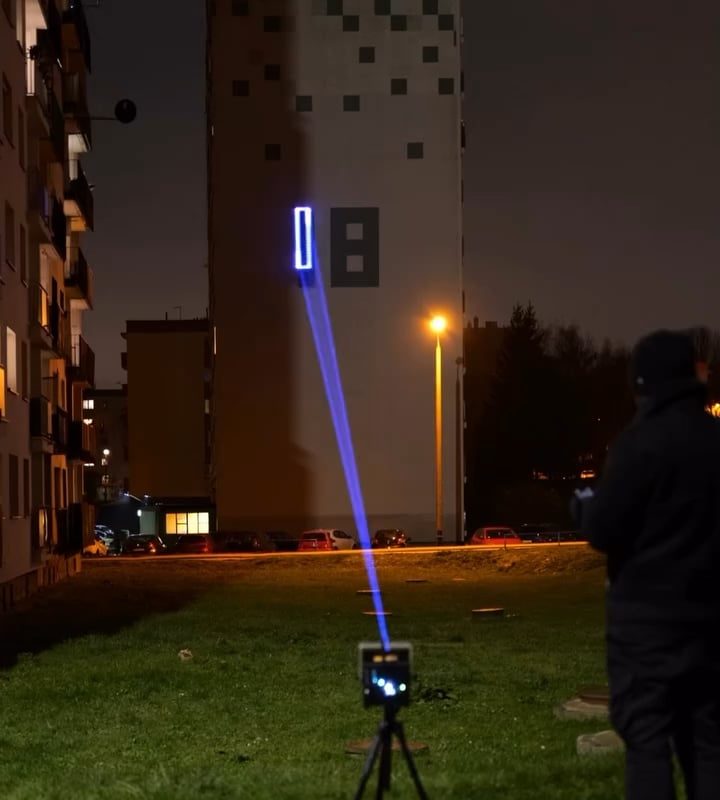
Laser mapping involves using LiDAR (Light Detection and Ranging) or terrestrial laser scanners to emit rapid laser pulses toward a building’s surfaces. The scanner measures the time it takes for the light to bounce back, calculating distances with millimeter-level accuracy. Thousands of measurements per second generate a “point cloud”—a digital 3D representation of the building’s geometry, including walls, windows, pipes, structural elements, and even fine architectural details.
How Does Laser Object Mapping Work?
- Setup & Scanning:
- A laser scanner is placed on a tripod at multiple strategic locations around/in the building.
- The device rotates 360 degrees, capturing millions of data points.
- Data Capture:
- Laser beams hit objects (e.g., beams, ductwork, façades) and record their position, size, and shape.
- High-resolution cameras (on some scanners) add color/texture data.
- Point Cloud Generation:
- Software stitches scans together, creating a unified 3D model.
- Model Conversion:
- The point cloud is converted into BIM (Building Information Modeling) files, CAD drawings, or interactive 3D maps.
Key Applications of Laser Mapping on Buildings
- Architectural Documentation:
- Preserve historical buildings with exact as-built records.
- Map complex geometries like ornate façades or curved roofs.
- Renovation & Retrofitting:
- Identify clashes between existing structures and new designs.
- Plan MEP (mechanical, electrical, plumbing) upgrades without guesswork.
- Structural Analysis:
- Detect deformations, cracks, or misalignments in walls or beams.
- Monitor structural health over time with repeat scans.
- Facility Management:
- Create digital twins for space optimization, maintenance, or emergency planning.
Top 5 Benefits of Laser-Based Building Mapping
- Extreme Precision:
- Achieve accuracy down to ±1–3 mm, eliminating human measurement errors.
- Time & Cost Savings:
- Complete scans in hours vs. weeks with traditional surveying.
- Reduce rework by detecting discrepancies early.
- Non-Intrusive & Safe:
- Scan hazardous areas (e.g., unstable structures, high ceilings) remotely.
- Comprehensive Data:
- Capture every visible object in 3D—even hidden elements via cross-sections.
- Future-Proof Assets:
- Digital models serve as a permanent reference for future projects or audits.
Laser Scanning vs. Traditional Surveying Methods
| Feature | Laser Mapping | Traditional Surveying |
|---|---|---|
| Speed | Minutes per scan | Days/weeks |
| Data Density | Millions of points | Sparse measurements |
| Detail Level | Sub-centimeter precision | Prone to human error |
| Versatility | Works in low light/dark | Requires line-of-sight & daylight |
| Output Formats | BIM, CAD, VR-ready | 2D drawings |
Choosing the Right Laser Scanner
- Phase-Based Scanners: Ideal for long-range outdoor scanning (e.g., façades).
- Time-of-Flight Scanners: Best for high-accuracy indoor environments.
- Mobile Scanners: Mounted on backpacks or drones for rapid large-area mapping.
Real-World Use Cases
- Heritage Conservation: The Notre-Dame Cathedral restoration team used LiDAR to recreate its exact pre-fire geometry.
- Industrial Plants: Oil refineries map piping networks to plan upgrades without shutdowns.
- Smart Cities: Municipalities digitize buildings for zoning compliance, disaster response, and urban planning.
FAQs About Building Laser Mapping
Q1: How much does laser scanning cost?
Costs depend on building size/scope (~$3,000–$15,000 for an average project). ROI comes from reduced rework and delays.
Q2: Can laser mapping penetrate walls?
No—it only captures visible surfaces. For hidden elements, pair with ground-penetrating radar (GPR).
Q3: Is training required to operate scanners?
Yes—certified technicians ensure accurate data capture and processing.
Conclusion
Laser mapping transforms buildings into living datasets, empowering smarter decisions across their lifecycle. Whether preserving history, modernizing infrastructure, or boosting facility efficiency, this technology delivers unmatched precision and scalability. As scanners become faster and more affordable, laser-based object mapping is no longer a luxury—it’s the new standard for building intelligence.
Ready to digitize your building? Consult a laser scanning professional to explore how this technology can elevate your next project.
Keywords for SEO:
3D laser scanning, building mapping, LiDAR technology, point cloud modeling, BIM integration, terrestrial laser scanner, as-built documentation, architectural survey, digital twin, facility management software.
Optimized for search intent: “how to map a building with lasers,” “benefits of laser scanning for construction,” and “3D building mapping services.”