Once in a lifetime capture of Supercell storm formation.
Nature’s Fury Unleashed: The “Once-in-a-Lifetime” Capture of a Supercell Storm Formation
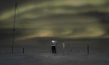
Mother Nature’s raw power is rarely captured with such awe-inspiring clarity as in the recent viral footage of a supercell storm formation — a moment experts are calling a “once-in-a-lifetime” meteorological spectacle. This spine-chilling event, recorded by storm chasers in the American Great Plains, showcases the explosive birth of one of Earth’s most formidable weather phenomena. For weather enthusiasts, photographers, and scientists alike, this footage offers a rare glimpse into the chaotic beauty of supercell thunderstorms — the kind that spawn devastating tornadoes, colossal hail, and lightning shows that electrify the sky.
What Are Supercell Storms, and Why Is Their Formation So Rarely Captured?
Supercells are the pinnacle of severe thunderstorms, distinguished by their deep, rotating updrafts called mesocyclones. Unlike ordinary storms, supercells sustain themselves for hours, fueled by wind shear and atmospheric instability. They’re responsible for nearly all violent tornadoes and extreme weather events — but witnessing their formation is incredibly rare.
Why?
- Timing is everything: Supercells erupt under highly specific atmospheric conditions. Capturing the transition from a mundane thunderstorm into a rotating monster requires luck, skill, and split-second timing.
- Dangerous proximity: Storm chasers must navigate torrential rain, hail, and unpredictable winds to record the earliest stages.
- Transient structure: The “formation phase” often lasts just minutes before the storm matures into a visible behemoth.
The Jaw-Dropping Footage: A Perfect Storm of Science and Luck
The now-famous footage, shot near Alliance, Nebraska, begins innocently: a towering cumulonimbus cloud billows upward. Within minutes, the storm’s updraft begins to rotate, sculpting a vaulted “mothership” structure — a hallmark of supercells — as warm air spirals violently into the atmosphere. The transformation is both mesmerizing and terrifying:
- “The Wedge” Emerges: The storm’s base lowers and morphs into a menacing, rotating wall cloud.
- Rain-Free Base: Unlike typical storms, supercells often feature a eerily calm, precipitation-free zone beneath the updraft — a deceptive lull before chaos erupts.
- Mesocyclone Dominates: Radar later confirmed a deep mesocyclone, with winds exceeding 100 mph, driving the storm’s longevity and destructive potential.
The videographer, veteran storm chaser Marcus Diaz, described the moment: “The sky looked alive — like it was breathing. One minute it was a storm, the next, a spinning beast. I’ve chased for 15 years, and this is my holy grail.”
Behind the Science: How Supercells Come to Life
Supercell formation isn’t random — it’s a precise dance of physics:
- Wind Shear: Changes in wind speed/direction with altitude create horizontal spin, which updrafts tilt vertically.
- CAPE (Convective Available Potential Energy): High CAPE values fuel explosive updrafts, lifting moist air until it condenses into the storm’s towering core.
- Dry Line Dynamics: In places like Tornado Alley, clashes between dry western air and moist Gulf air act as a “trigger” for supercells.
These ingredients converged perfectly in Nebraska, allowing the storm to organize into a self-sustaining, rotating engine of destruction.
Why This Footage Matters Beyond the Spectacle
While visually stunning, the footage is more than just viral content:
- Scientific Insight: Meteorologists can study the storm’s genesis to improve tornado prediction models.
- Public Safety: Highlighting early supercell characteristics helps communities recognize danger faster.
- Climate Clues: Extreme storms like these may intensify with climate change; understanding their formation is critical.
Braving the Storm: The Risky Art of Storm Chasing
Capturing this supercell required extraordinary effort. Storm chasers like Diaz use Doppler radar apps, GPS tracking, and mobile mesonet systems to predict a storm’s path while avoiding deadly hazards like:
- Tornado Vortices: Even small spin-ups can flip vehicles.
- Baseball-Sized Hail: Windshield-shattering ice missiles are common.
- Flash Flooding: Rain-swollen ditches trap unwary drivers.
“You’re racing to get into position, then racing to escape,” Diaz admits. “But when nature delivers something like this, it’s worth every close call.”
The Takeaway: A Humbling Reminder of Nature’s Power
This once-in-a-lifetime capture immortalizes a fleeting moment of atmospheric alchemy — a reminder of humanity’s fragility amid Earth’s forces. For researchers, it’s invaluable data. For viewers worldwide, it’s pure, primal awe.
Want to See It Yourself?
Search for “supercell formation Nebraska” on YouTube or weather forums to witness the haunting footage. But remember: while supercells fascinate, they demand respect. Always heed warnings from the National Weather Service, and leave the chasing to professionals with armored vehicles and years of training.
Meta Elements for SEO Optimization
- Title Tag: Rare Supercell Storm Formation Captured: A Once-in-a-Lifetime Event
- Meta Description: Watch the unforgettable moment a supercell thunderstorm forms in Nebraska. Learn the science behind these “king of storms” and why this footage stunned meteorologists.
- Keywords: supercell storm formation, mesocyclone, rare weather event, tornado formation, storm chasing footage, Nebraska supercell
- Internal Links: Tornado safety tips, best storm chasing gear, how climate change affects severe weather
- External Links: National Weather Service (NOAA), Storm Prediction Center, American Meteorological Society
Engage With Us!
Have you ever witnessed a supercell? Share your story in the comments below, or tag #SupercellCapture on social media!